The coming choice of a contractor for the Epping Way phase of the Wolf River Greenway is the latest sign that the 23-mile path is nearing reality.
When plans for the Wolf River Greenway began nearly a decade ago it might’ve seemed far-fetched and a dream to create a trail that follows the Wolf River east from Germantown to its confluence with the Mississippi north of Downtown. But the 23-mile trail is coming into focus with phases nearing construction.
The first couple of miles stretching from Walnut Grove Road east to Shady Grove Road along the south banks of the Wolf River were completed in 2010. Since then, Germantown has connected its portion of the path to what lies in Memphis. Up next is work on stretches on the north side of the city.
The Wolf River Conservancy board is set to review bids over the next month for a 1-mile stretch between North Highland Street and James Road, known as the Epping Way property. The section will include a driveway entrance off Highland, an asphalt parking lot, two pedestrian bridges, landscaping and recreational site amenities.
![]()
Bob Wenner, Greenway Coordinator with the Wolf River Conservancy, said he’s hopeful that several segments of the $40 million project will follow this year, as many as six of the 13, depending on permitting and right-of-way issues. And once segments are built the conservancy will donate the sections to the city of Memphis.
The Wolf River Greenway is a partnership between the conservancy and the city of Memphis that began in 2009. The conservancy’s goal is to focus on building sections within the city of Memphis, taking it from where it ends near Baptist Memorial Hospital at Humphreys Boulevard and Walnut Grove Road and extending it 23 miles to the north end of Mud Island.
That work won’t occur in an orderly fashion; rather, 13 segments will be constructed as they can. For example, the section northwest of Shelby Farms that passes through the construction zone around the Interstate 40/240 flyover will wait until that project is complete.
“We believe we’ll accomplish this by 2018, 2019,” Wenner said. “That’s the goal we’ve set for completing this. What we’ve done is taken that and broken it into what we call bite-sized pieces that total 13.”
The 13 phases are in various design stages. The sections targeted for the bidding process next are scattered geographically.
“On paper you’d say let’s start at one end and work to the other,” Wenner said. “That was the goal in 2009 but we very quickly realized that’s not practical. There are some railroad crossing issues and road crossing issues that will take longer to get approval.”
Chuck Flink, a senior adviser with Alta Planning and Design, said the individual phases all present unique personalities and challenges. But he said the smaller phases allow for more local contractors to connect to the project. For example, there were six contractors who recently bid on the Epping Way phase.
The conservancy and city held a ceremonial groundbreaking for the Kennedy Park section of the Greenway last fall. It came at a symbolic point of the project, as its first seven phases of design were more than halfway complete. Kennedy Park is the city’s largest park at 260 acres, and the hope is that after a trailhead is established there, it will become a more utilized park by the surrounding community.
There are challenges beyond maneuvering around an interstate construction zone and crossing railroads and streets. The remoteness of some of the landscapes add to concerns about how to open it to public access. Flink said his team spent several months last fall and early winter conducting meetings to get a better understanding of concerns and how to overcome them.
Public safety was one.
“We’re paying particular attention to how to make the trails safe and how to make sure they’re properly patrolled and managed so people feel safe using them,” he said. “We’re connecting a lot of neighborhoods together with essentially a linear park system.”
Creating a safe trail starts with what Flink called open and clean sightlines, making it so users can see deep into a corridor with lots of open space. The installation of cameras that are tied to the city’s real-time crime center will help.
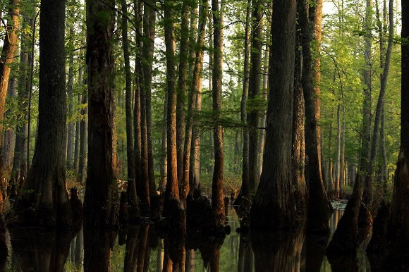
The Wolf River Conservancy began in 1985 as an effort to protect its namesake river, which had been declared one of America’s dead rivers. Today, the organization – an accredited land trust – focuses on the floodplain lands that follow the Wolf River. More than that, it focuses on the larger watershed, which is much of Shelby County and the lands to the east.
The conservancy’s signature project came in 1995 when it saved the Ghost River portion of the river between Moscow and LaGrange in Fayette County. Since that time, the conservancy has done a number of property transactions to protect floodplain lands, some 15,000 acres.
Today, the conservancy also is focused on improving the Memphis area’s green infrastructure.
“A lot of what a community does is planning its gray infrastructure with its streets and sewer lines,” Wenner said. “As a region we need to plan for our green infrastructure or we won’t have any. The majority will get developed.”
![]()
Regional green infrastructure looks at parks, trails and aquifer recharge areas and the linkage between them. Shelby Farms Park is the region’s biggest green hub, which now has more connections to other areas thanks to the growing Shelby Farms Greenline and the Wolf River Greenway.
The conservancy’s role in that infrastructure includes looking at property transactions with three principles in mind: that it be continuous, larger to provide more habitat for plants and animals, and to reduce the edge or jaggedness of a space.
The health of the Memphis region is dependent on projects such as the Wolf River Greenway, Wenner said. And the path’s journey through northern reaches of the city, touching North Memphis, Frayser and Raleigh as it makes its way east toward Shelby Farms, Germantown and Collierville is vital for those communities that lack trails and don’t have many bike lanes.
“When we talk to people in those communities they welcomed the idea of a trail coming through,” Wenner said. “They want to see the connection and this type of investment in their neighborhoods. We haven’t heard anybody say this doesn’t make any sense. It’s not about the trail. It’s about how the community chooses to use the trail for their benefit. … These aren’t elitist projects. I see it just the opposite. Why shouldn’t a community like Douglass Park have a greenway for their community?”
The 10- to 12-foot wide paved path will be built to national standards, including meeting Americans With Disabilities Act guidelines. The trail will connect neighborhoods and give additional benefits to those who live in those communities.
“We’re talking about a trail for all people, all abilities,” Wenner said. “Back before Patriot Lake was being redone by Shelby Farms Park, if you walked it or got on the Greenway or the Greenline you really saw all makes and models, a real cross-section of Memphis. Yeah, you saw some experienced cyclists but then you saw some people on bicycles that maybe this was their first time in many years being on a bicycle. It’s not about bicycles. It’s a pathway people can get on and walk or run, however they choose to use the trail and get out to enjoy nature.”
High Ground's coverage of community sustainability efforts is made possible by Memphis Light, Gas and Water.