There’s an eight-foot drop into the drainage ditch behind St. Stephen Baptist Church at 503 North Third Street that is accessible only after jumping a short chainlink fence.
Five of us have chosen to venture into the underground Gayoso Bayou.
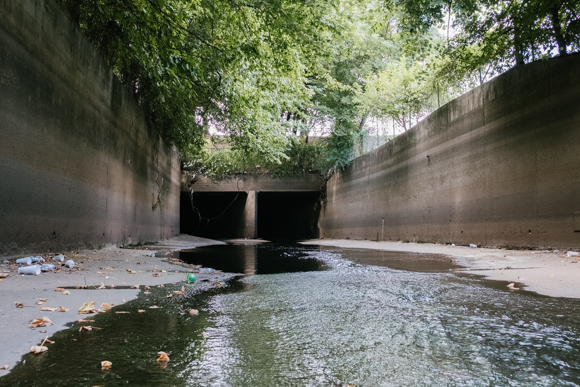
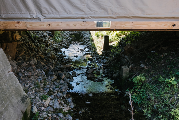
We took a short walk through the open-air ditch to the first decision we made — which of three tunnels to proceed through. We chose the entrance on the far right, and soon found two more paths before us. Again, we chose the path to the right, and we found ourselves properly inside the first culvert, one of many tunnels that run underground and whisk away stormwater to the Mississippi River.
Immediately, we were outside the reach of sunlight.
![]()
Nearly all of the Gayoso Bayou has now been hidden underground. Encased in concrete, the creek feeds flooding patterns into the Mississippi River and protects the above-ground development of Downtown, which hugs the riverfront.
At the time the city of Memphis was founded in 1819, the Gayoso Bayou was a five-mile-long open creek that drained into the Mississippi River. Historically, Memphis was a swampy region, and several bayous ran throughout the city’s center. The Gayoso, which runs through Uptown and The Pinch, is the northernmost bayou of these waterways.
Named for Manuel Gayoso, the Spanish governor of the Louisiana Territory from 1791 to 1799, the Bayou originally ran a course that aligns roughly with present-day Danny Thomas Boulevard and Lauderdale Street.
The oldest maps of Memphis show the Gayoso Bayou acting as Memphis' eastern border. In 1849, J. Oliver and William Borden Greenlaw purchased land at the city’s border to build the Greenlaw Expansion, which pushed development closer to the river. Now, the Greenlaw Expansion is best known by the name of Uptown, and the vein of the Gayoso Bayou still runs beneath the neighborhood.
![]()
Related: "Uptown & The Pinch: How Memphis’ oldest subdivision became its newest boom town "
According to Wayne Dowdy, who manages the Memphis and Shelby County Room special collection with the Memphis City Library, “Gayoso Bayou created the conditions which helped establish the first neighborhood in the Uptown and Pinch area. River workers parked their flatboats near where the bayou met the Wolf River to avoid the Mississippi's swift current while others built houseboats and lived there more or less permanently.”
Dowdy went on to say that the wealthy Memphians of the area looked down on their less fortunate neighbors, calling this area “Catfish Bay.” It was at this time that poorer residents in the area built shanties on the shore where the Gayoso Bayou met the Mississippi River — this became known as the Pinch.
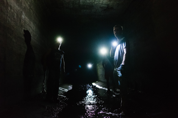
![]() Four urban explorers make their way up the Gayoso Bayou, navigating by flashlight. (Brandon Dahlberg)
Four urban explorers make their way up the Gayoso Bayou, navigating by flashlight. (Brandon Dahlberg)
“The neighborhood was considered a nuisance by local government and in the early 1830s the Board of Aldermen ordered everyone out of the neighborhood. They refused to leave and after a contentious city election a boat filled with animal waste floated into Catfish Bay and overturned. The water was so contaminated that the residents who lived on the houseboats in the bay were forced to flee,” Dowdy said.
After the Civil War ended in 1865, the city built several bridges over the bayou, and development ensued.
In 1910, under E.H. Crump’s tenure as mayor, the city began to encase the bayou in concrete. That development allowed roads to be constructed over the Gayoso Bayou and expanded the city's underground infrastructure improvements to the city's storm drain and sewer systems.
On occasion, the creek would flood, and moving it underground served as a solution to prevent water damage. That effort met mixed success. While flooding risk was generally reduced, a large flood in 1937 overwhelmed Uptown’s drainage infrastructure and damaged development in the neighborhood.
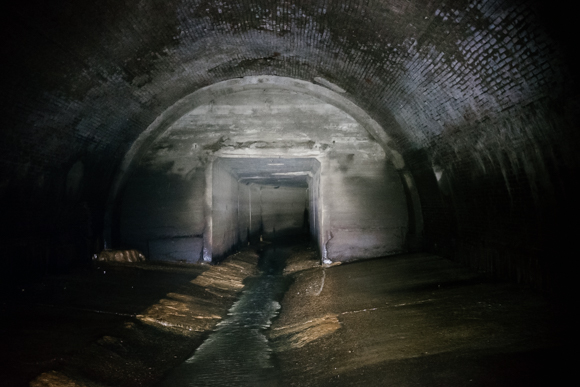
![]() The first large room the group comes to, where concrete culverts built in the 1930s intersect with much older city infrastructure built in the aftermath of the Civil War. (Brandon Dahlberg)
The first large room the group comes to, where concrete culverts built in the 1930s intersect with much older city infrastructure built in the aftermath of the Civil War. (Brandon Dahlberg)
Presently, FEMA considers the entire course of the Gayoso in Uptown a flood zone.
Today, the Gayoso Bayou is linked to the rest of the city’s expansive drainage system and is critical to allowing stormwater that would otherwise cause flooding to safely flow into the Mississippi River. During heavy rain, water can be as much as eight feet deep inside the culverts.
The Gayoso Bayou is difficult to access, and even more difficult to traverse. Without sunlight, and due to treacherous footing, one could easily find his or herself injured or lost in this subterranean labyrinth. Because of the risk, the City of Memphis discourages urban exploration in the storm drains.
![]() The group investigates concrete walls that surround the underground Gayoso Bayou. (Brandon Dahlberg)
The group investigates concrete walls that surround the underground Gayoso Bayou. (Brandon Dahlberg)
Despite our caution, almost everyone in the group stumbled and fell along the culvert during our mid-summer exploration. The acoustics of the tunnel magnify all sounds — a distant trickle sounds like a waterfall.
The air was heavy but surprisingly odorless. While many confuse storm drains with sewers, it is important to understand that the city’s storm drains carry no sewage or toxic materials. Storm drains and sewers share many physical similarities but serve very different purposes. The city’s sewers carry wastewater to treatment facilities for processing, while the storm drains carry sanitary runoff from storms straight to the Mississippi River. The only material our group encountered was water and what little trash had accumulated since the last storm.
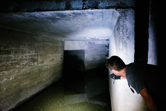
![]() One of the group members shines his flashlight down a culvert with deeper water. (Brandon Dahlberg)
One of the group members shines his flashlight down a culvert with deeper water. (Brandon Dahlberg)
The first culvert we entered, a square, 12-foot wide concrete tunnel, was constructed in the 1930s as part of a New Deal project. But the history of the Gayoso Bayou begins long before these tunnels were built. For those lucky enough to see the infrastructure of the Gayoso Bayou first hand, the experience offers an intimate look at the city’s inner workings and history.
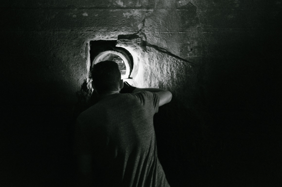
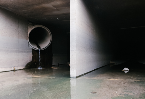
![]() One of the group members shines his light down drainage piping that ends in the culvert. (Brandon Dahlberg)
One of the group members shines his light down drainage piping that ends in the culvert. (Brandon Dahlberg)
At the end of our journey, we crawled through a small tunnel, roughly three feet in diameter, intending to exit the drainage tunnels through a manhole cover safely off the street on Danny Thomas Boulevard. Unfortunately, we discovered this exit had been sealed. Before committing to retrace our steps to the entrance and figuring out a way to scale the eight-foot wall we initially dropped down, our guide explored one more exit tunnel. With some effort, he was able to remove that manhole cover, and the group quickly ascended to the surface.
While the majority of the Gayoso is out of sight for Memphians, locals can still enjoy the waterway. A portion of the bayou is exposed in Downtown Memphis at Loflin Yard.
One participant, who asked to remain anonymous given the illegality of the exploration, said, “For me, it really helped me get my head around the idea of early Memphis being this place crisscrossed by bayous and steams. Even if it’s underground and surrounded by concrete there’s something powerful about standing in the waters of the old Gayoso Bayou and imagining what it used to be. It might be one of the most intimate ways possible to engage with the city’s past.”
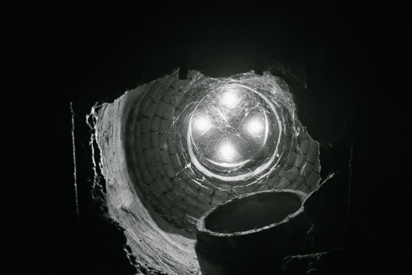
![]() Sunlight enters the culvert through weepholes in a manhole cover underneath St. Jude Children's Research Hospital. (Brandon Dahlberg)
Sunlight enters the culvert through weepholes in a manhole cover underneath St. Jude Children's Research Hospital. (Brandon Dahlberg)
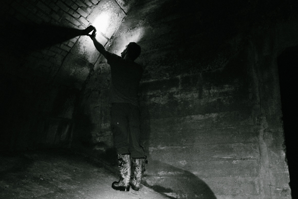
![]() A group member touches a stone archway, remnants of an old bridge built after the Civil War. (Brandon Dahlberg)
A group member touches a stone archway, remnants of an old bridge built after the Civil War. (Brandon Dahlberg)
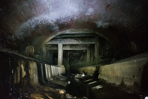
![]() The entryway to the second large room, and the end of the line for this expedition, reveals a combination of the newer, concrete drainage infrastructure integrated with older brickwork. (Brandon Dahlberg)
The entryway to the second large room, and the end of the line for this expedition, reveals a combination of the newer, concrete drainage infrastructure integrated with older brickwork. (Brandon Dahlberg)
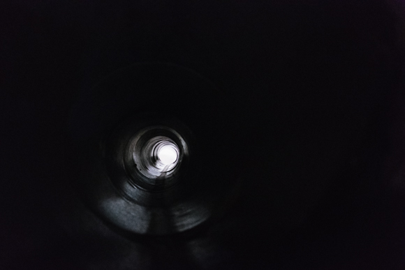
![]() Sunlight is visibile at the end of a long drainage tunnel leading into the Gayoso Bayou from a street level storm drain. (Brandon Dahlberg)
Sunlight is visibile at the end of a long drainage tunnel leading into the Gayoso Bayou from a street level storm drain. (Brandon Dahlberg)
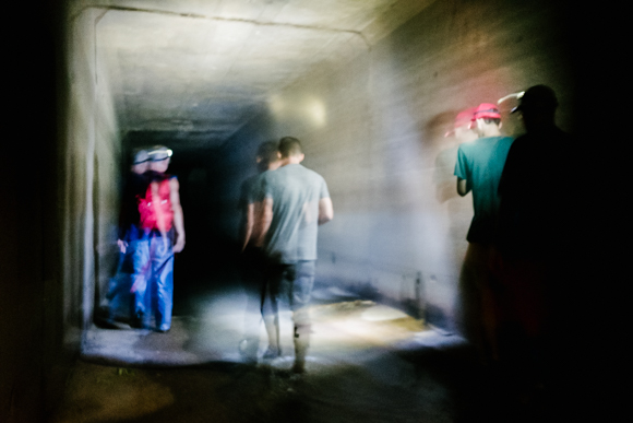
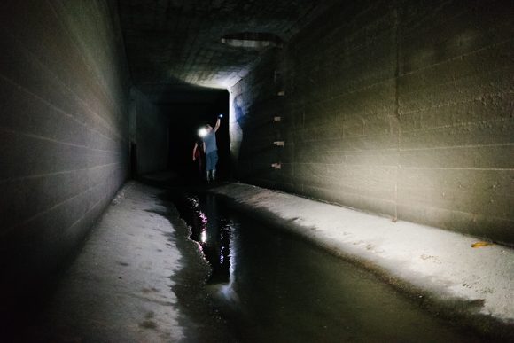
![]() The group of urban explorers moves through the culvert shortly after entering the covered portion of the Gayoso Bayou. (Brandon Dahlberg)
The group of urban explorers moves through the culvert shortly after entering the covered portion of the Gayoso Bayou. (Brandon Dahlberg)
![]() The Gayoso Bayou runs through the property at Loflin Yard in one of its few exposed portions. (Brandon Dahlberg)
The Gayoso Bayou runs through the property at Loflin Yard in one of its few exposed portions. (Brandon Dahlberg)